
Tsunamis: What to Know
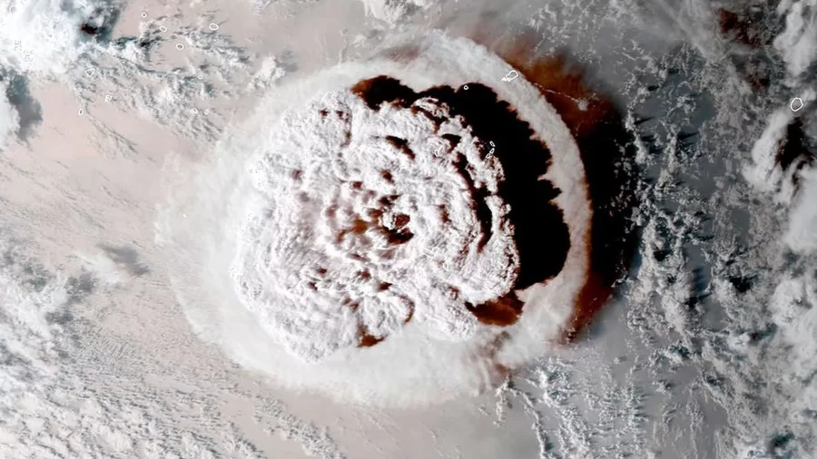
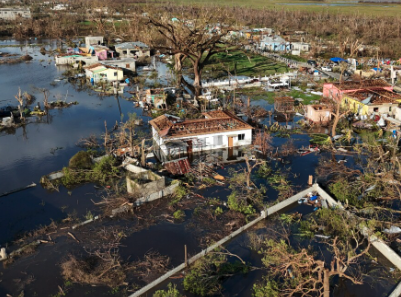
On January 15, the Hunga-Tonga-Hunga-Ha’apai underwater volcano erupted off the coast of Tonga. The eruption caused tons of ash and smoke to fill the air, as well as a tsunami below the water surface. Tonga is a small island country located on the Ring of Fire in the pacific ocean; a region where 75% of the earth’s volcanoes and 81% of the earth’s largest earthquakes occur. The abundance of seismic activity also causes most of the earth’s tsunamis. The tsunami caused by the Ring of Fire’s most recent eruption was felt in places such as New Zealand, Hawai’i, Japan, and the west coast of the United States.
The waves flushed through Tonga causing havoc. However, as it reached California, it was almost hard to tell if a catastrophic event occurred; the real fear came from the media. As the tsunami was approaching the US, the National Weather Service (NWS) issued a tsunami watch for the whole west coast, causing panic. Many turned to social media platforms to express their concern. Lexi Black (‘24) opened TikTok and “started panicking.” She said, “I rushed over to my family and dog because I thought they were in trouble.”
In reality, California was almost unaffected by the tsunami. According to the NWS, the sea level rose 1.4 feet in San Diego Bay and only 6 inches in La Jolla. Other parts of California experienced surges up to 4.3 feet, like in Port San Luis Obispo Bay. No land damage was reported.
Californians and the rest of the world were baffled. “Is this really what a tsunami looks like?” they asked themselves. In general, tsunamis are formed when there is a massive displacement of water, caused by violent seafloor activity like earthquakes or volcanoes. The water travels below the surface in the deep ocean. When it approaches shallower waters, which is usually near land mass, the waves breach the surface and grow in height. They can also travel fast, around 500 miles per hour.
However, taking into account the distance that this particular tsunami traveled to reach San Diego, which is about 5,337 miles, the wave lost much of its energy traveling that lengthy distance. This still leaves the unsettling question in every San Diegans head: Do I need to worry about a tsunami?
Looking at San Diego’s geography, there are no major tectonic plate boundaries nearby. Tectonic plate boundaries are the main cause for earthquakes and volcanic eruptions around the world. On the rare occasion that one occurs near San Diego, it is probably not significant enough to create panic, like the one on January 15. Even though the San Andreas fault line goes through eastern San Diego County, the earthquakes that do happen are usually not powerful enough to create disruption in the nearby waters.